Aquatic ecosystems Monitoring using NASA’s EMIT and ECOSTRESS Mission

The IEEE Metropolitan Los Angeles and Coastal Section Geoscience and Remote Sensing Society Joint Chapter Present a Special Lecture Event!

Aquatic ecosystems Monitoring using NASA’s EMIT and ECOSTRESS Mission

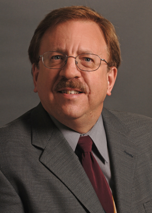
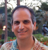
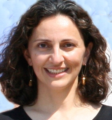
Dr. Kelly Luis, Aquatic Ecosystem Scientist
Jet Propulsion Laboratory, California Institute of Technology

Tuesday, June 17, 2025
5:30–7:30 PM

Biology and Biological Engineering (BBB), Room B180
California Institute of Technology
Pasadena, California

And over Zoom at https://tinyurl.com/mla-grss-talk-06-25

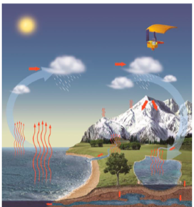
About the Talk: Aquatic ecosystems are complex, dynamic interfaces shaped by interactions between land, water, and the atmosphere. Yet, they remain challenging to monitor consistently across spatial and temporal scales. NASA’s EMIT (Earth Surface Mineral Dust Source Investigation) and ECOSTRESS (ECOsystem Spaceborne Thermal Radiometer Experiment on Space Station) missions offer new capabilities for observing these environments. EMIT’s imaging spectroscopy provides surface reflectance measurements that can support assessments of water quality, and intertidal and benthic habitat composition. ECOSTRESS complements this with thermal observations that help identify thermal gradients, urban runoff patterns, and hydrologic connectivity. This talk highlights how the integration of EMIT and ECOSTRESS data is expanding our toolkit for aquatic ecosystem monitoring, with applications ranging from early detection of water quality changes to improved understanding of ecosystem function and resilience. Case examples will illustrate how these missions are helping connect space-based observations to local decision-making.

About the Speaker: Dr. Kelly Luis is an aquatic ecosystem scientist at NASA’s Jet Propulsion Laboratory (JPL), where she advances the use of satellite and airborne remote sensing to monitor water quality and aquatic habitat dynamics. She serves as the aquatic algorithm lead for the Surface Biology and Geology (SBG) mission’s Visible to Shortwave Infrared (VSWIR) instrument and as the Aquatic Applications Lead for the Earth Surface Mineral Dust Source Investigation (EMIT) mission. In addition, Kelly serves as an Associate Program Manager for NASA’s Water Resources Program, where she leads coordination of agency-wide efforts focused on water quality applications.

Her work emphasizes community-based partnerships to adapt NASA’s inland and coastal water quality products to meet local decision-making needs. Her applied research spans satellite-based water clarity monitoring in New England, harmful algal bloom detection along the West Florida Shelf and Southern California, and assessments of thermal stress and urban impacts on coastal water quality in Hawai‘i. She holds a Ph.D. and M.S. in Marine Science and Technology from the University of Massachusetts Boston, and a B.A. in Environmental Science from Columbia University.

Directions and Parking: Parking on the Caltech campus is accessible from Michigan Avenue, south of Del Mar Avenue. Parking is free after 5 pm.

Building location: https://www.caltech.edu/map/campus/the-mabel-and-arnold-beckman-laboratories-of-behavioral-biology

Sign up here to join our mailing list: https://forms.gle/AX6prWF6H79V9cuZ8

Please see the event flyer for agenda and other details.

2024 IEEE GRSS IFT-MIRS TC Joint Summer School hosted by MLA GRSS Chapter

Date: October 4-5, 2024 (Friday and Saturday)

Venue: California Institute of Technology, Biology and Biological Engineering (BBB), Room B180

Address: 1200 E California Blvd, Pasadena, CA 91125

Registration: Secure your spot today! Registration is on a first-come, first-served basis, with a $20 registration fee*. Register here

*Includes access to lectures, coffee during break, and lunch for both days

——————————————————————————————————–

Introduction: The Instrumentation and Future Technologies (IFT) and Modeling in Remote Sensing (MIRS) technical committees of the IEEE Geoscience and Remote Sensing Society (GRSS) are thrilled to announce a joint summer school dedicated to exploring the frontiers of remote sensing technologies. This program is designed to equip aspiring scientists and engineers with the knowledge and skills needed to navigate the rapidly evolving landscape of remote sensing. Gain insights into groundbreaking advancements and their transformative applications across various fields.

For more information about the school, please visit: Summer School Agenda and Details

Don’t miss this exceptional opportunity to expand your horizons in the captivating realm of remote sensing!

IGARSS 2023

The MLA GRSS Chapter is the host GRSS chapter for the annual GRSS flagship conference in 2023: IGARSS 2023. It will be held in Pasadena in July this year. The online registration for IEEE IGARSS 2023 is now open. In particular, please note the deadline for the lower-cost advance registration is 19 May 2023 and the deadline for author registration is 2 June 2023. Each accepted paper must be covered by at least one registration by 2nd June 2023.

 Registration includes publication of a maximum of two manuscripts. The registration page and policy can be found at https://2023.ieeeigarss.org/registration.asp

We are looking forward to welcoming you to IGARSS 2023!

Webinar of the SAR Capacity Building Special Topic SWOT

The 4th Webinar of the SAR Capacity Building meet-ups is jointly organised together with Sisters of SAR and the IEEE GRSS LA Chapter. We invite you for a networking session during our GeoMixer, followed by our main webinar session where our speakers, Margaret Srinivasan (NASA JPL/SWOT Deputy Program Applications Lead) and Dr. Lee-Lueng Fu (NASA JPL/SWOT Project Scientist) are going to introduce us into the technicalities and applications of the upcoming radar altimetry SWOT Mission.

Event time: 19 November, 9:00 PST

Event Agenda:

  • 9-10 am – Geomixer (fun way to meet people from around the globe working on various aspects of SAR)
  • 10 – 11 am – Intro / Talks
  • 11 – 11:30 am – Q&A

(See link below for full more details)

Location: Zoom -> Registration required.

This SAR-CB/SoS/IEEE GRSS Metro LA event is open to public.

To register follow the link and register on Eventbrite: 

https://www.eventbrite.co.uk/e/184757333157

Webinar of the SAR Capacity Building Special Topic NISAR

The 3rd Webinar of the SAR Capacity Building meet-ups is jointly organized together with Sisters of SAR and the IEEE GRSS Metro LA Chapter.

We invite you for a networking session during our GeoMixer, followed by our main webinar session where our speakers, Dr. Cathleen Jones (NASA JPL/NISAR Science Team Applications Lead) and Dr. Paul Rosen (NASA JPL/NISAR Project Scientist), are going to introduce us into the technical aspects and applications of the upcoming NISAR Mission (NASA/ISRO).

Event Topic: NISAR MISSION

Event Date: November 5th 9:00AM PST

Event Agenda:

  • 9-10 am – Geomixer (fun way to meet people from around the globe working on various aspects of SAR)
  • 10 – 11 am – Intro / Talks
  • 11 – 11:30 am – Q&A

(See link below for full more details)

Location: Zoom -> Registration required.

This SAR-CB/SoS/IEEE MLA GRSS event is open to public.

To register follow the link and register on Eventbrite:

https://www.eventbrite.co.uk/e/sar-capacity-building-meet-up-3-sar-cb-x-sos-x-ieee-grss-la-nisar-tickets-184741114647


Evidence of Global Mean Increases in the Frequency of Daily and Sub-daily Heavy Precipitation

IEEE MLA GRSS Webinar

Evidence of Global Mean Increases in the Frequency of Daily and Sub-daily Heavy Precipitation

Speaker: Dr. Maria Chinita, University of Los Angeles and Dr. Mark Richardson, Colorado State University

Thursday June 24, 2021
12:00 PM US Pacific Time

Zoom: https://zoom.us/j/97002478050?pwd=OUVuYi9MeXN0MEt6a2xmaGFzY0dqUT09 

Abstract:

In a warming climate and assuming moisture availability, heavy precipitation is expected to increase at approximately 7% per degree of warming according to the Clausius-Clapeyron relationship, whereas total global precipitation is capped at ~2% K by atmospheric energy balance constraints. Such disproportionality suggests that extreme events increase at the expense of moderate and light events.

In this seminar, we will present what is, to our knowledge, the first global analysis of frequency changes in hourly and daily heavy precipitation by exploiting the 1/4° spatial resolution of the latest ERA5 reanalysis. Our robust metric captures local changes across both wet and dry regions, and avoids several known statistical biases. We report that during 1989—2018, the event that occurred one hour per year in 1979—1988 increased in frequency by 71 [53—93, 2σ range] %, while the one day per year extreme event frequency increased by 44 [37—54] %. Our results replicate prior findings that relative frequency increases are larger for increasingly rare events and for the first time we quantify that the mean frequency increase is substantially greater over the global ocean than over global land.

We will also investigate the fidelity of our results by validating ERA5 against the Frequent Rainfall Observations on GridS (FROGS) daily database. Finally, we will discuss statistical issues that cause biases in trends of rare event frequencies, and show simple methods to identify and mitigate these biases.

Speaker’s Bio:

Dr. Maria Chinita completed her PhD at the University of Lisbon, Portugal in 2018, where she studied strongly stable boundary layers and turbulence decomposition of convective flows using Large-Eddy Simulations. She joined JIFRESSE in 2019 to work on the improvement of the planetary boundary layer representation in General Circulation Models by implementing and evaluating the Eddy-Diffusivity Mass-Flux parameterization. She is also interested in the study of extreme events which is the scope of this presentation.

Dr. Mark Richardson is a research associate at Colorado State University and JPL. He develops satellite cloud retrievals and has published on changes in temperature, precipitation and cloud properties, combining climate model output with satellite and in-situ data.

Career Development

Panel Discussion and JPL Postdoc and Internship Info Session

Wednesday, February 17, 2021
2:00 – 3:30 PM US Eastern time
11:00 – 12:30 PM US Pacific time

Moderator: Mehmet Ogut, Technologist, JPL
Opening Talk:
Mariko Burgin, Executive VP, IEEE GRSS and Systems Engineer, JPL
Opportunities and Application Process:
Rowena Dineros (PostDoc Office, JPL), Jenny Tieu (Education Office, JPL)
Panelists:  Simon Yueh (Editor-in-Chief, IEEE TGRS and Principal Scientist, JPL), Paul Stek (Deputy Section Manager – Instruments Electronics and Software, JPL), Naiara Pinto (Postdoc Advisor and Intern Mentor, JPL), Omkar Pradhan (JPL Postdoctoral Fellow), and Carissma L. McGee (Intern, JPL)

Webinar Flyer

Publishing in Nature: A Remote Sensing and Climate Perspective

SF Bay Area Joint IEEE-GRSS Chapter Webinar Series

Publishing in Nature: A Remote Sensing and Climate Perspective

Speaker: Dr. Michael White, Senior Editor in Physical Sciences at Nature handling Climate Science submissions

Thursday July 30, 2020
4.00-5.00 PM PDT


Register Here

About This Event:

Join us for the first event hosted by the official SF Bay Area IEEE-GRSS Chapter!

Understanding the inner workings of high-profile scientific journals can often be mysterious ventures. As such many questions around the publication process and decision making policy may appear confusing at times; Questions like how do they decide what to publish, or even to send out to review? How is the process managed? What are the odds of getting published? Do they publish papers only in the interests of being controversial and getting press coverage? And who makes the decisions?

In this first in a series of recurring webinars hosted by the newly established SF Bay Area Joint IEEE-GRSS Chapter, Dr. Michael White, Senior Editor of Physical Sciences in Nature will discuss the overall journal processes and common themes behind the remote sensing and climate science research published in Nature over the past decade.

A zoom link for the event will be provided in a follow-up email from eventbrite once you’ve confirmed your registration. You must register for the zoom meeting IN ADDITION TO this registration! Please do not distribute the zoom link publicly – only registered attendees should have access.
Speaker’s Bio:
Dr. Michael White is a Senior Editor in Physical Sciences at Nature handling Climate Science submissions. Prior to joining Nature in 2008, Dr. White was a professor at Utah State University, focusing on research in terrestrial ecosystem modeling and remote sensing as it pertains to large-area ecology, terrestrial carbon cycle and land surface phenology.

Webinar on mmWave Remote Sensing

IEEE MLA GRSS Webinar

Millimeter-wave Remote Sensing

Speaker: Kent Anderson, Northrop Grumman Electronic Systems Retiree

Wednesday May 13, 2020
14:00 GMT/UTC
7:00 AM US Pacific Time

Register Here

Abstract: A discussion of space-based millimeter-wave remote sensing. Topics include data products and applications; phenomenology and underlying theory of operation; and instrument implementation approaches, including hardware and algorithms. Comparisons are made between different mission and instrument architectures to contextualize the driving requirements for sensor precision and accuracy.

Speaker’s Bio:
Kent Anderson received the B.S. and M.S. degrees in electrical engineering from the Rose Hulman Institute of Technology, Terre Haute, IN, USA, in 1971 and 1972, respectively. He has 30-year experience in systems engineering for spaceborne remote sensing systems. For the last 15 years, he has been the Lead Systems Engineer for Civil Space Programs with Northrop Grumman Electronic Systems, Azusa, CA, USA, focused primarily on millimeter-wave radiometry, particularly for the ATMS program. His research interests include requirements management, initial design trade studies, performance analyses, and analyses of test data.

For more information on the lecture, visit the event description page.

IEEE Metro LA GRSS Online Study/Work Support Group

IEEE Metro LA GRSS Online Study/Work Support Group

Do you want to remove distractions during work? Are you looking for a community of like-minded workers? IEEE Metropolitan Los Angeles Geoscience and Remote Sensing Chapter (IEEE MLA GRSS) introduces a new series of online events to help you stay focused and be productive. Join us online for up to a 2 hour and 20 min study session via Zoom to build a strong and supportive community to help you get things done!

We will break the entire study session into THREE SPRINTS40 min each. During each sprint, we will encourage you to focus on ONE TASK and help you keep off distractions. We will have a 5-min break between each sprint for relax and stretch. You are free to leave before the entire session ends. But we encourage you to stay at least for one 40-min sprint.

We also encourage you to start from the most difficult work to help you get things done. You are welcomed to share your tasks that you would like to work on at the beginning of our study group and report your progress at the end.

Feel free to join us during the following time slots of your choice to get your things done!


February 24, 2 pm – 4:20 pm, Pacific Time

February 26, 9 am – 11:20 am, Pacific Time

March 3, 2 pm – 4:20 pm, Pacific Time


Please sign up via the following link to join. You can find more information in the attached flyer and share the event with your colleagues and students.

https://forms.gle/6L477U93QaE8rE9G7


Check out the Calendar file in the attachment for Zoom links and ways to join us online. This event and our other events can be found from the following Google Calendar as well:

https://calendar.google.com/calendar/embed?src=qi0oa8016ss1qvvf8brnbqr444%40group.calendar.google.com&ctz=America%2FLos_Angeles

If you have questions, please contact us at [email protected]

Introduction to Imaging Spectrometer Data Analysis: Concepts, Methods and Open Source Software

Introduction to Imaging Spectrometer Data Analysis:
Concepts, Methods and Open Source Software

20 July 2019, 8:00 AM – 4:00 PM
California Institute of Technology, South Mudd Room 162

Register with: David R. Thompson, [email protected]
Jet Propulsion Laboratory, California Institute of Technology

Imaging spectroscopy, also known as Hyperspectral Imaging, is revolutionizing remote sensing.  Spectroscopy enables quantitative mapping of materials and chemistry across wide areas.  Future orbital missions by NASA and other agencies will provide these data on global scales.

This is a sequence of hands-on lab experiences using open source code for imaging spectrometer data analysis.  We will introduce the basic concepts behind these instruments, and provide practical experience in visualization, atmospheric correction, and surface property estimation with rigorous uncertainty propagation. We will use the open-source ISOFIT codebase (https://github.com/isofit/isofit) for atmospheric correction, and OpenSPEC for visualization capability similar to that provided in the ENVI interface.  Following the Workshop, tutorial materials will be made available as open source resources for participants to use in their own courses.

Participants should bring a laptop.  We will provide Python library installation instructions in advance

Tentative Agenda
8:00 AM    Setup
8:30        Introduction to imaging spectroscopy
              Covariance, dimensionality, and noise
              Linear dimensionality reduction
              Spectral subspaces and angles
10:00       Questions and break
11:30         Atmospheric correction
              Linear mixture models and continuua
              The Matched Filter
              Partial Least Squares  Regression
12:00 PM    Lunch break
1:00         Radiometric Calibration
              Spectral Calibration and Noise Estimation
2:30          Questions and Break
3:00        Optimal Estimation methods
              Other Advanced topics in Optimal Estimation
4:00           Adjourn

Convener: Dr. David R. Thompson is a researcher and Technical Group Lead in the Imaging Spectroscopy group at the NASA Jet Propulsion Laboratory. He is Science Lead for NASA’s EMIT mission, and Investigation Scientist for the AVIRIS imaging spectrometers. He is recipient of the NASA Early Career Achievement Medal and the JPL Lew Allen Award.

Directions: South Mudd is located at the corner of California and Wilson, in the California Institute of Technology. We will use the East entrance, and meet in room 162. Parking is available in the underground lot to the South, as indicated on the map.

Acknowledgements: A portion of this research was performed at the Jet Propulsion Laboratory, California Institute of Technology. We acknowledge the support of a PRISM AITT grant from the National Aeronautics and Space Administration (NASA) Earth Science Technology Office. We acknowledge the support of the JPL and Caltech Presidents’ and Directors’ Fund Program. We thank other supporting sponsors including the NASA Earth Science Division for the HyspIRI preparatory campaign, the AVIRIS-NG instrument and the data analysis program “Utilization of Airborne Visible/Infrared Imaging Spectrometer Next Generation Data from an Airborne Campaign in India” NNH16ZDA001N-AVRSNG, for its support of the algorithm development; the Jet Propulsion Laboratory Research and Technology Development Program; and the NASA Center Innovation Fund managed in conjunction with the Jet Propulsion Laboratory Office of the Chief Scientist and Technologist. Copyright 2019 California Institute of Technology. US Government Support Acknowledged.

Machine Learning Application for Satellite Image Analysis

The IEEE Los Angeles Geoscience and Remote Sensing Society Chapter Present a Special Lecture Event!

Machine Learning Application for Satellite Image Analysis: Methods and Case Studies

Vinay Viswambharan, Shairoz Sohail, and Sangeet Mathew
Esri Image Team and Esri A.I. Team

Thursday, May 30, 2018
5:30–7:30 PM

Arms Laboratory, Sharp Lecture Hall
California Institute of Technology
Pasadena, California

About the Talk: Remote sensing specialists from academia and industry have been using the latest progress in artificial intelligence to find more efficient and accurate methods to extract knowledge from the huge collection of satellite images accumulated in the past 30 years. In this talk, members from Esri’s imagery and A.I. teams will explain the technical details of using cutting edge machine learning and deep learning methods to analyze multi-source remote sensing data. The methods will be presented in an intuitive way and accessible to those with a light coding background. They will present use cases of using machine learning tools on Esri’s collection of remote sensing imagery to solve real world problems such as quickly detecting polluted swimming pools, identifying the unhealthy palm trees, and detecting damaged structures and roads post disaster. The presenters will also share their experiences about working at Esri and where the future of A.I and remote sensing is headed.

About the Speakers:

Vinay Viswambharan is a product manager on the Imagery team at Esri, with a zeal for remote sensing and everything imagery. He has been working in geospatial industry for 20 years. He is also very active in developing case study classes for the Esri LearnGIS and MOOC program.


Sharioz Sohail is a data scientist on Esri’s GeoAI team. He works mainly on building deep learning models for aerial and satellite imagery, LiDar, drone feeds, and live video. He routinely solves problems from object detection and tracking, image classification, semantic segmentation, NLP, and other areas.


Sangeet Mathew is a senior software engineer at Esri. He is an experienced Product Engineer. His work focuses on Software QA, Programming Languages, Agile Methodologies, Software Design & Machine Learning. Certified in A.I. & Deep Learning.


Directions and Parking: Parking on the Caltech campus is accessible from Michigan Avenue, south of Del Mar Avenue. Parking is free after 5 pm. Arms Lab location: http://www.caltech.edu/map/charles-arms-laboratory-of-the-geological-sciences

Reservation: Please RSVP with your IEEE membership # to [email protected]. You are welcome to bring your spouse as a guest. Non-members can go to www.ieee.org/join, then send your membership number.

Please see the event flyer for agenda and other details.

ATLIS: Advanced Technology Land Imaging Spectroradiometer: a Next Generation Sustainable Land Imager

The IEEE Los Angeles Geoscience and Remote Sensing Society Chapter and University of Southern California Present a Special Lecture Event!

ATLIS: Advanced Technology Land Imaging Spectroradiometer: a Next Generation Sustainable Land Imager

Dr. Jeff Puschell
Principal Engineering Fellow and Chief Scientist Space Systems at Raytheon Space and Airborne Systems in El Segundo

Wednesday, Oct 24, 2018
6:00–8:00 PM

EEB 132, Viterbi School of Engineering
University of Southern California,
Los Angeles, CA 90089

About the Talk: The Advanced Technology Land Imaging Spectroradiometer (ATLIS) is a small (0.04 m3), multispectral pushbroom imager to provide visible through shortwave (VSWIR) calibrated imagery for the Sustainable Land Imaging-Technology (SLI-T) reference mission architecture (RMA).

ATLIS is designed to provide imaging spectroradiometry that meets SLI-T RMA key parameters with an instrument that is much smaller and much less massive than previous land imaging systems.

This presentation describes a NASA ESTO funded project to design, build and test a six spectral band prototype ATLIS called ATLIS-P that will establish whether this compact, low mass design approach with wide field of view (WFOV), free form reflective telescope, large format, small detector digital FPA and on-chip processing meets SLI-T RMA VSWIR requirements. ATLIS is supported by NASA ESTO through grant NNX16AP64G.

About the Speaker: Dr. Jeff Puschell is Principal Engineering Fellow and Chief Scientist, Space Systems at Raytheon Space and Airborne Systems in El Segundo, California. He is an internationally recognized expert in the system engineering of space-based imaging and remote sensing systems. His 30+ years of experience is broadly based and includes leading and making major contributions to development of visible-infrared instruments for space-based research and operational environmental imaging and remote sensing, development and field testing of laser-based communication and remote sensing systems and building and using millimeter, infrared, visible and ultraviolet wavelength instrumentation for ground-based astronomy. Dr. Puschell has been Principal Investigator, Technical Director, Chief Engineer, Chief Scientist or Project Manager on more than 15 projects in space-based remote sensing and laser communication. He has authored or co- authored 130+ papers on a variety of topics in space-based imaging and remote sensing, optical communication and astrophysics. Dr. Puschell is co-editor and co-author for the leading reference book Space Mission Engineering: The New SMAD. He is a Fellow of the AIAA and SPIE.

Directions and Parking: Parking Reservations @ Downey Way Structure ($12.00 / Day) at USC Viterbi School of Engineering accessible off Exposition Blvd, University Park, Los Angeles, CA 90089: Directions

Reservation: Please RSVP at Eventbrite jere: https://www.eventbrite.com/e/atlis-advanced-technology-land-imaging-spectroradiometer-lecture-event-tickets-50099738667

WebEx Information: If you cannot join in person, please join in remotely through WebEx: https://ieeemeetings.webex.com/ieeemeetings/j.php?MTID=m32c824c7b991d69f27ec0ca42bde71a7
Meeting number: 597 555 127
Meeting password: sm4d3XFZ

Contact information: Please contact us at [email protected] if you have any questions

Please see the event flyer for agenda and other details.

Talk on Visual Pattern Recognition

IEEE Foothill Section Computer Society Chapter Meeting

Wednesday July 11, 2018
DeVry University Pomona

Room 210 (40 seats available, RSVP required)

901 Corporate Center Dr., Pomona, CA 91768
https://www.devry.edu/universities/california/pomona-campus.html

Free parking available around the building, located near the intersection of the I-10 & 57 Freeways; see link for directions.

Agenda
7:00 P.M. – 7:20 P.M. Networking – Pizza & soda provided
7:20 P.M. – 7:30 P.M. Announcements/Intros – Bill Grist, Computer Society Chair
7:30 P.M. – 8:45 P.M. Presentation/Lecture
8:45 P.M. – 9:00 P.M. Questions & Answers

Topic: Visual Pattern Recognition …
 Speaker: Brad Morantz, Ph.D.,
 IEEE Computer Society Phoenix Chapter

Abstract: Biological Neural Processing As a Paradigm for Visual Pattern Recognition

            Many of us are aware that human (and animal) visual imaging and pattern recognition can outperform that of our best computer systems.  Imagine if we could emulate some of this power and use it in our defense and intelligence systems.

            This lecture will begin by explaining what this biological vision processing is and how it works, to the best knowledge of our current science.  Sensing, image processing and formation, and finally pattern recognition will be covered.  This will be compared to various implementations of computer vision and then there will be some models, discussion, and ideas on how we can further implement these concepts from nature into our systems.

  • Image recognition, it is not just looking at something
  • What is the organ of vision?
  • Do I see what I think I see?
  • How do we see?
  • Image Pattern recognition is not just about seeing something
  • Understanding how we recognize what we think we see

About the Speaker

Dr. Morantz has a B.S. in C.I.S. and E.E., a M.S. and Ph.D. in Decision Science, a mixture of mathematical science, psychology, and computer science. He has additional post doctoral course work in Computational BioScience, Computer Science, statistical design methodology, and Design Analysis Simulation Experiments (DASE).  Dr. Morantz has published and presented on neural networks, multiprocessing mathematics, biologically inspired computing architecture, data-mining, and intelligent decision making. His current research is in biologically inspired computing for intelligent decision making. He is currently Sr Staff Scientist for Bluemont Technology & Research, Inc of McLean VA. He is also on the editorial board of the International Journal of Data Mining, Modeling, and Management. Regarding IEEE, he is a senior IEEE member and Vice Chair of the Phoenix IEEE Computer Society.  He is also a member of the IEEE Computational Intelligence Society and his website is www.machine-cognition.com

All Students & the Public Are Welcome to Attend

Event Sponsored by DeVry University – www.devry.edu IEEE Foothill Section – www.ieee-foothill.org

Please RSVP  at https://www.eventbrite.com/e/ieee-computer-soc-visual-pattern-recognition-presentation-devry-july-11-2018-tickets-47485221576
RSVP no later than 2pm on July 11, 2018

WCOM: a new Chinese satellite mission for studies of the global water cycle

The IEEE Los Angeles Geoscience and Remote Sensing Society Chapter Present a Special Lecture Event!

WCOM: a new Chinese satellite mission for studies of the global water cycle

Dr. Jiancheng Shi
State Key Laboratory of Remote Sensing Science, Beijing, China

Wednesday, May 30, 2018
5:30–7:30 PM

Arms Laboratory, Sharp Lecture Hall
California Institute of Technology
Pasadena, California

About the Talk: The Water Cycle Observation Mission (WCOM) is the first Earth science driven satellite mission of China with the most synergetic capabilities for global water cycle observations. WCOM is currently under engineering phase and will be launched around 2020.

WCOM aims to measure the global water cycle under global changes through synchronous acquisition of its key elements in an accurate manner. Key elements including soil moisture, ocean salinity, snow water equivalent, soil freeze-thaw, atmospheric water vapor, precipitation and other associated parameters will be measured by improving the accuracy and synchronization. The resulted consistent and accurate datasets will enable us to refine the long-term satellite observations over the past decades, and to represent the changing trend in hydrological elements which are needed for global change studies.

The mission concept of WCOM satellite is a combination of active and passive microwave remote sensors with a wide frequency coverage. The WCOM satellite will be flown with a 6:00 am/pm sun synchronous polar orbit at about 600 km height. The WCOM satellite design provides not only the most sensitive microwave information of the target element but also the environmental variables which are needed in the retrieval algorithms.

About the Speaker: Dr. Jiancheng Shi received his B.A. in Hydrogeology and Engineering Geology from the University of Lanzhou in China, and his M.A. and Ph.D. degrees in Geography from the University of California, Santa Barbara (UCSB) in 1982, 1987, and 1991, respectively.  He then worked the Institute for Computational Earth System Sciences (later Earth Research Institute) at UCSB as a research professor.  In 2010, he joint Institute of Remote Sensing and Digital Earth, Chinese Academy of Sciences as director and senior research scientist at the State Key Laboratory of Remote Sensing Science in Beijing, China. His research interests are microwave remote sensing of water cycle related components. He has published more than 300 journal and conference papers. He is a PI of Chinese Global Water Cycle Mission and Fellows of IEEE and SPIE.

Directions and Parking: Parking on the Caltech campus is accessible from Michigan Avenue, south of Del Mar Avenue. Parking is free after 5 pm. Arms Lab location: http://www.caltech.edu/map/charles-arms-laboratory-of-the-geological-sciences

Reservation: Please RSVP with your IEEE membership # to [email protected]. You are welcome to bring your spouse as a guest. Non-members can go to www.ieee.org/join, then send your membership number.

Please see the event flyer for agenda and other details.

Earth, Air, Fire, & Water: Monitoring Natural Hazards in California

Special Panel Event at the Northrop Grumman Azusa Campus sponsored by Northrop Grumman and the IEEE Geoscience and Remote Sensing Society Chapter in Los Angeles!

Earth, Air, Fire, & Water: Monitoring Natural Hazards in California

Thursday, May 10, 2018
5:00–7:00 PM

Northrop Grumman Campus
Azusa, California

Panel Members

  • Andrea Donnelan, Principal Investigator of NASA’s GeoGateay project, NASA’s Jet Propulsion Laboratory, Pasadena, CA
  • Mark Jackson. NOAA Meteorologist In Charge (MIC) for Los Angeles& Oxnard, CA
  • Tom Pagano, Systems Architect and Project Manager at NASA’s Jet Propulsion Laboratory, Pasadena, CA

RSVP: 

US Citizen: To attend, please RSVP here: https://goo.gl/forms/Bzez1rvf5G8R454z2 by Tuesday, May 8th. It is pertinent that you RSVP byTuesday, May 8th so that an accurate Northrop Grumman visitor list can be generated allowing a seamless security check-in process.  If you have any problem, please email [email protected].

Non-US Citizen: The deadline for RSVP has passed, sorry!

Directions:  Northrop Grumman is easily accessible from the 210 freeway with entrances and exits just east of campus off Vernon Avenue. Please see the Northrop Grumman Visitor’s Guide for detailed directions.

Parking:  Parking is available outside the Building 59, Executive Lobby on Hollyvale Street (as indicated on map). Additionally, there is an overflow parking lot just southeast of Bldg. 59, off 3rd street. Parking is free and unlimited.

Check-in:  Check-in will be located in Northrop Grumman’s Building 59, Executive Lobby from 5:00pm-5:45pm. Northrop Grumman is a closed campus and all visitors are required to furnish proof of identification prior to entering the campus.

Please see the flyer for more information.

Laser Cooling and Trapping on ISS

OSSC and IEEE GRSS and Photonics Chapters in Metropolitan Los Angeles Present a Special Lecture & Dinner Event!

Laser Cooling and Trapping on ISS

Dr. Rob Thompson
Jet Propulsion Laboratory

Wednesday, April 11, 2018
6:00–8:00 PM

St. Gregory Church
2215 East Colorado Boulevard
Pasadena, California

About the Talk: Microgravity offers a wealth of advantages for studies of ultra-cold atomic gases and their applications.  These include the ability to achieve exceptionally low temperatures via expansion into very weak traps, which don’t need to be supported against gravity and the ability to achieve very long interaction times with samples that have been released from traps. The Cold Atom Laboratory (CAL) will be a flexible, multi-user ultra-cold atom facility that will enable the precise study of quantum gases at effective temperatures well below the coldest achievable on Earth. CAL will launch to the International Space Station in early 2018, giving scientists a unique window into the quantum world.  CAL is supported by SLPS and ISS-PO. Jet Propulsion Laboratory, and the California Institute of Technology.

About the Speaker: Dr. Rob Thompson developed the mission concept for the Cold Atom Lab, and is the Project Scientist for the project. He has over twenty-five years of research experience and numerous publications in atomic and molecular physics, laser physics, and cavity quantum electrodynamics. His current research interests include studies of degenerate quantum gases in microgravity; space-based quantum sensors; and optical clocks. He received his Ph.D. from the University of Texas at Austin.

Visit here for Registration & Details

Please see the event flyer for agenda and other details.

Metro LA IEEE GRSS Panel Discussion Event 

SAVE THE DATE

Metro LA IEEE GRSS Panel Discussion Event 

“Fire and Water: How Are We Monitoring Natural Hazards in Southern California?”

Thursday, May 10, 2018, 5-7 PM
Northrop Grumman, Azusa

 Last year’s panel event was so successful that we are doing another again this year.  Don’t miss out this time if you didn’t make it last time.  This year’s topic is “Fire and Water: How Are We Monitoring Natural Hazards in Southern California?”.  We are lining up experts in sensor fabrication and users of the data in the field.  Stay tuned for more information to register.  Registration will be required by April 19th  to gain access to the facility.

More details to follow in near future.

GRSS Webinar: Airborne Thermal Infrared Hyperspectral Imaging for Mineral Mapping

GRSS Webinar: Airborne Thermal Infrared Hyperspectral Imaging for Mineral Mapping

Alexandrine Huot
Wednesday, January 24, 2018
10:00 AM Pacific Time (6:00 PM GMT/UTC)

Next Tuesday’s speaker is Alexandrine Huot, a Field Application Scientist for Telops, who will demonstrate the benefits of using thermal infrared hyperspectral imaging (TIR HSI) for mineral mapping during an airborne survey, in this case carried out over an open-pit mine in the Thetford Mines (Qc, Canada) area. The results show how the high spectral resolution data provided by the Telops Hyper-Cam airborne system facilitates temperature emissivity separation (TES) and atmospheric correction in order to retrieve a thermodynamic temperature map of the area and its associated spectral emissivity datacube. Mineral mapping of various minerals such as lizardite, serpentinite and quartz was achieved through linear unmixing of the emissivity data using reference emissivity curves found in spectral libraries. The results illustrate the potential of TIR HSI for airborne mapping of silicate minerals. 

The lecture will be broadcast live from Quebec, Canada at 4:00PM GMT/UTC on February 13. (This is 8:00AM February 13, US Eastern Time.)

If you would like to tune in to this free webinar, click here to register.

For more information on the lecture, visit the event description page.


GRSS Webinar: Statistical Information Theory and Geometry for SAR Image Analysis – Alejandro C. Frery

GRSS Webinar: Statistical Information Theory and Geometry for SAR Image Analysis

Alejandro C. Frery
Tuesday, February 12, 2018
8:00 AM Pacific Time (4:00 PM GMT/UTC)


Next Wednesday’s speaker is Prof. Alejandro Frery, a GRSS Distinguished Lecturer, who will discuss the main statistical distributions used for SAR, and then apply them to eight seemingly different problems in remote sensing.

The lecture will be broadcast live from Universidade Federal de Alagoas, Brazil at 6:00PM GMT/UTC on January 24. (This is 1:00PM January 24, US Eastern Time.)

If you would like to tune in to this free webinar, click here to register.

For more information on the lecture, visit the event description page on IEEE.tv.

Christmas Unplugged: Reclaiming the Holiday Spirit on Dec 16

The IEEE Metropolitan Los Angeles Section and IEEE Los Angeles Geoscience and Remote Sensing Society Chapter Present a Special Event!

Christmas Unplugged: Reclaiming the Holiday Spirit

John Doan
Saturday, December 16, 2017
3:00–6:10 PM

Hagga Hall, Huntington Library
1151 Oxford Rd
San Marino, CA 91108

Tickets : $10 for each adult
Must Buy Tickets at: 
https://www.eventbrite.com/e/christmas-unplugged-reclaiming-the-holiday-spirit-tickets-40958033581?aff=erelpanelorg

Directions: https://goo.gl/maps/iL2sk4ZZk932
Parking Information: Parking is free. Entry into the Huntington Library grounds is not necessary to attend the concert.

Description: Emmy-Nominated musician, storyteller and harp guitarist, John Doan presents his acclaimed program “Christmas Unplugged – Reclaiming”. the Holiday Spirit.”  Nominated for “Best Entertainment Special of the Year”, “Christmas Unplugged” is a refreshing and magical escape from the frenzy of our times. Experience Christmas past as if it were today with group sing-alongs and whistle-alongs, archival photographs, and the sound of a century old instruments, such as a harp guitar, classical banjo, and various zithers.  John’s physical comedy, interspersed with fine musicianship, makes for a fun filled evening for all ages. 
Short Clip about John’s earlier events and an interview
https://www.youtube.com/watch?v=qKWB3J9jsxg
https://youtu.be/1VVJcPKt9bw

Agenda:
3:00-4:00 – Social Hour
4:00 to 4:20 –  Opening remarks by IEEE region, Section and Societies
4:20 –  John performs act 1
6:10  –  End of Performance

Christmas Unplugged: Reclaiming the Holiday Spirit on Dec 15

The IEEE Metropolitan Los Angeles Section and IEEE Los Angeles Geoscience and Remote Sensing Society Chapter Present a Special Event!

Christmas Unplugged: Reclaiming the Holiday Spirit

John Doan
Friday, December 15, 2017
7:00–10:00 PM

7th Day Adventist Church
770 North Glendora Avenue
Glendora, CA 91741

Tickets : $15 for each adult
Must Buy Tickets at: 
https://www.eventbrite.com/e/christmas-unplugged-reclaiming-the-holiday-spirit-tickets-40752703433?aff=erelpanelorg

Description: Emmy-Nominated musician, storyteller and harp guitarist, John Doan presents his acclaimed program “Christmas Unplugged – Reclaiming”. the Holiday Spirit.”  Nominated for “Best Entertainment Special of the Year”, “Christmas Unplugged” is a refreshing and magical escape from the frenzy of our times. Experience Christmas past as if it were today with group sing-alongs and whistle-alongs, archival photographs, and the sound of a century old instruments, such as a harp guitar, classical banjo, and various zithers.  John’s physical comedy, interspersed with fine musicianship, makes for a fun filled evening for all ages. 
Short Clip about John’s earlier events and an interview
https://www.youtube.com/watch?v=qKWB3J9jsxg
https://youtu.be/1VVJcPKt9bw


Electron-Beam Fabricated Diffractive Optics for Earth and Space Applications

The IEEE Los Angeles Photonics Society Chapter Present a Special Lecture Event!

Electron-Beam Fabricated Diffractive Optics for Earth and Space Applications

Dr. Daniel Wilson
Jet Propulsion Laboratory

Thursday, October 19, 2017
5:30–7:30 PM

Moore Laboratory of Engineering, Room B270
California Institute of Technology
Pasadena, California

About the Talk: Electron-beam fabricated diffractive optical elements have proven to be enabling for a variety of NASA instruments. By combining the precision of the electronbeam tool with carefully calibrated fabrication techniques, three-dimensional surfaces can be created with accuracies down to tens of nanometers. This allows us to fabricate high-performance diffractive optics such as precisely blazed gratings and computer-generated holograms that are designed using optical wavefront engineering algorithms. Further, we have developed techniques for e-beam writing on curved surfaces, allowing us to fabricate convex or concave gratings for compact imaging spectrometers, many of which have flown on airborne and spaceborne missions (e.g. Compact Reconnaissance Imaging Spectrometer for Mars, Moon Mineralogy Mapper, and Portable Remote Imaging Spectrometer). We have also developed techniques for e-beam fabricating grayscale phase-profiled occulting spots for exoplanet imaging coronagraphs, and spot array generators for the Mars 2020 rover. This presentation will give an overview of our diffractive optics fabrication techniques and the instrument applications.

About the Speaker: Dr. Daniel Wilson is a Principal Engineer in the JPL’s Instrument Electronics and Sensors Section. He leads JPL’s efforts in developing high-performance imaging spectrometer gratings and has research interests in the design and electron-beam fabrication of diffractive optical elements and instruments. He joined JPL in 1994 and has a PhD in Electrical Engineering from Georgia Institute of Technology. He was awarded JPL’s Lew Allen Award for Excellence and the NASA Exceptional Technology Achievement Medal for his work on e-beam fabricated gratings.

Directions and Parking: Parking on the Caltech campus is accessible from Michigan Avenue, south of Del Mar Avenue. Parking is free after 5 pm. Moore Lab location: http://www.caltech.edu/map/the-gordon-and-betty-moore-laboratory-of-engineering 

Reservation: Please RSVP with your IEEE membership # to [email protected]om. You are welcome to bring your spouse as a guest. Non-members can go to www.ieee.org/join, then send your membership number.

Please see the event flyer for agenda and other details.

CLASTECH 2017 by IEEE

CLASTECH 2017 by IEEE

Description

October 20, 2017 — Advanced Registration closes 10/13

Friday, from 8:30 AM to 3:30 PM, for the 2017 CLASTECH Symposium and Exhibition. We will be back at the Proud Bird- the renovation has been great, so come by and check it out. The format will be the same as the previous years, with engaging talks, table top exhibits, and good food, for $20 early registration, or $40 onsite (same as last year). To register, visit https://www.eventbrite.com/e/clastech-2017-tickets-36808043850.

Parking is Free!

Check out the web page- www.clastech.org

Contact [email protected] for more information

Preliminary Antenna Talks

“Monolithic Optical Phased Arrays “, by Prof. Hossein Hashemi, USC
“Time-Varying Electromagnetic Systems”, by Prof. Ethan Wang, UCLA
“Low cost phased-arrays for Ku- and Ka-band SATCOM and 5G “, by Prof. Gabriel Rebeiz, UCSD
“Liquid-crystal Based Reconfigurable Holographic Metamaterial Electronically Scanned Antennas “, by Dr. Nathan Kuntdz, Kymeta.
“HFSS Dynamic Range Reduces Trips to the Antenna Range”, by Dr. Larry Williams, Ansys.

Preliminary Microwave Talks

“Engineered and Full 3D RF Materials”, by Dr. Vesna Radisic Northrop Grumman
“Plasmonic Terahertz Devices for High-Sensitivity Terahertz Imaging and Sensing Systems “, by Prof. Mona Jarrahi, UCLA
“Time Domain Measurements for Test Site Validation above 1 GHz: Implications of Site VSWR Measurement Uncertainties on Radiated Emissions Measurements”, by Zhong Chen, ETS-Lindgren
“PolyStrata Technology: Enabling New Architectures for Phased Arrays”, by David Sherrer, president of Nuvotronics.
“Proposed Guidelines for Space Qualification of GaN HEMT Technologies”, by John Scarpulla, Aerospace Corp

How to map the Earth, or what was the Shuttle for anyway?

The IEEE Los Angeles Geoscience and Remote Sensing Society Chapter Present a Special Lecture Event!

How to map the Earth, or what was the Shuttle for anyway?

Dr. Michael Kobrick
Jet Propulsion Laboratory

Wednesday, September 6, 2017
5:30–7:30 PM

Arms Laboratory, Sharp Lecture Hall
California Institute of Technology
Pasadena, California

About the Talk: Remember when the world was flat? Not any more.  In February, 2000 NASA sent six astronauts aboard the Space Shuttle Endeavour on an 11-day mission to gather data for the first complete three-dimensional global elevation map of Earth.

The 12 terabytes of raw radar data they collected has been processed into a near-global digital elevation model with 30 meter sampling and vertical accuracy exceeding all the usual standards. The elevation information is easily the most popular and frequently downloaded data set at the land processes distribution archive, and after combining with data from other missions will form the soon to be released NASADem, a single-stop-shopping source for the best (and free!) global digital elevation data available.

Mike will describe what the Space Shuttle was originally intended for, how it evolved, and how a single good idea can turn into a mission that NASA Headquarters has called the single most important accomplishment of the Space Shuttle program.

About the Speaker: Dr. Michael Kobrick is the Project Scientist for the Shuttle Radar Topography Mission at Caltech’s Jet Propulsion Laboratory. He holds degrees from several well-meaning institutions of higher learning, including a doctorate from UCLA in Planetary and Space Physics, and for 44 years at JPL has specialized in radar remote sensing of the Earth and planets.

Before conceiving the SRTM mission he was a Principal Investigator on numerous spaceborne radar experiments dating back to the Apollo program. He served as Science Manager for the Magellan mission to map Venus with radar, and has several thousand exciting flight hours on NASA’S DC-8 research aircraft using JPL’s airborne imaging radar system. His current research interests center on the derivation of digital topographic data from interferometric radar sensors and their geoscientific applications.

Directions and Parking: Parking on the Caltech campus is accessible from Michigan Avenue, south of Del Mar Avenue. Parking is free after 5 pm. Arms Lab location: http://www.caltech.edu/map/charles-arms-laboratory-of-the-geological-sciences

Reservation: Please RSVP with your IEEE membership # to [email protected]. You are welcome to bring your spouse as a guest. Non-members can go to www.ieee.org/join, then send your membership number.

Please see the event flyer for agenda and other details.

Infrared Sources and Detectors for Deep-Space Science

The IEEE Los Angeles Photonics and Geoscience and Remote Sensing Society Chapters in Los Angeles Present a Special Lecture Event!

Infrared Sources and Detectors for Deep-Space Science

Dr. Ryan M. Briggs
Jet Propulsion Laboratory

Thursday, August 3, 2017
5:30–7:30 PM

Moore Laboratory of Engineering, Room B270
California Institute of Technology
Pasadena, California

About the Talk: This presentation will describe recent progress in two technology areas relevant to space science: mid-infrared lasers for molecular spectroscopy and superconducting single-photon detectors for optical communication. We have designed and fabricated distributed-feedback quantum cascade lasers for targeted detection of compounds in planetary atmospheres using in situ infrared laser absorption spectroscopy techniques. The lasers are designed for use in low-power instruments; therefore, emphasis is placed on minimizing laser operating current and reducing thermal dissipation to ~1 W. Device performance will be discussed for lasers emitting in the 4 to 10 μm wavelength range.

In order to increase communication bandwidth beyond the limits of existing radio-frequency links, NASA continues to support the development of optical communication transceivers for testing on the next generation of planetary science missions. To resolve signals transmitted from spacecraft several astronomical units away from Earth, we have developed superconducting nanowire single-photon detectors for a ground receiver at 1550 nm wavelength. The principle of operation and fabrication techniques for the detectors will be presented, and performance will be discussed for multi-pixel detector arrays developed for the first deep-space optical communication demonstrations.

About the Speaker: Ryan Briggs received his Bachelor of Science in Engineering Physics from Colorado School of Mines and his PhD in Materials Science from the California Institute of Technology. He joined the Microdevices Laboratory at JPL in 2011. Dr. Briggs has expertise in design and fabrication of integrated photonic devices, antimonide-based interband lasers, quantum cascade lasers, and optoelectronic device packaging. He is currently Principal Investigator for “Low-Power Long- Wavelength Infrared Sources for Tunable Laser Spectrometers on New Frontiers and Discovery Missions,” under the NASA Planetary Instrument Concepts for the Advancement of Solar System Observations Program.

Directions and Parking: Parking on the Caltech campus is accessible from Michigan Avenue, south of Del Mar Avenue. Parking is free after 5 pm. Moore Lab location: http://www.caltech.edu/map/the-gordon-and-betty-moore-laboratory-of-engineering

Reservation: Please RSVP with your IEEE membership # to [email protected]. You are welcome to bring your spouse as a guest. Non-members can go to www.ieee.org/join, then send your membership number.

Please see the event flyer for agenda and other details.

2017 GRSS Summer School + Young Professional Event

Join us for the 2017 GRSS Summer School + Young Professional event from July 19- 21, 2017 in Arlington, Texas!  The young professional event is organized by MLA GRSS Chapter!

An elevator pitch can be one of the simplest yet most powerful tools for a researcher to network effectively with other researchers or to get your message heard by management. An elevator pitch should be short, clear, conversational, and intelligible to both non-researchers and researchers not in your niche area. It should: define who you are, describe what your research does, identify your target customers, and explain what’s unique about your research. But simply being able to craft “short” messages is not enough, it should be catered to the person you are pitching the idea to and allow them to understand and appreciate the impact and value of our research. More importantly, it’s not a sales pitch, rather an opportunity to make a good impression that will lead to a deeper dialogue about what you and your research can offer.

At this year’s GRSS Summer School (Wed-Fri, July 19-21) come and learn more about remote sensing theory and practical applications by learning from world-renowned leaders in the field. At the Young Professionals event (Fri afternoon, July 21), hone your elevator pitch skills in small teams while networking with other students, young professionals, and summer school lecturers. Each team will make their best pitch during the Networking Dinner on Friday evening in front of their fellow participants and select members of the IEEE GRSS Administrative Committee. A prize (and honor & glory) awaits the best pitch!

For more information and to register, check out the website!

The IEEE Los Angeles Photonics and Geoscience and Remote Sensing Society Chapters Present a Special Lecture Event!

The IEEE Los Angeles Photonics and Geoscience and Remote Sensing Society Chapters in Los Angeles Present a Special Lecture Event!

UV Detectors and Imaging Arrays

Dr. Micheal Hoenk
Jet Propulsion Laboratory

Wednesday, May 10, 2017
5:30–7:30 PM

2475 E Huntington Dr
San Marino, California

About the Talk: Surface passivation has been a challenge for silicon devices from the beginning, having played a critical role in the development of field-effect transistors and VLSI circuits. Early efforts to develop back-illuminated silicon detectors for ultraviolet astronomy were fraught with surface passivation problems. After discovering a critical problem with detectors in Hubble Space Telescope’s Wide-Field Planetary Camera, researchers at the Jet Propulsion Laboratory (JPL) pioneered several approaches to the passivation of silicon detectors, including the use of molecular beam epitaxy to grow a surface passivation layer on back-illuminated CCDs. Uniquely among all methods previously explored, delta-doped CCDs achieved nearly 100% internal quantum efficiency and exceptional stability. Several challenges remained in development of these detectors for spaceflight. With the recent development of wafer-scale bonding and thinning technologies, and following JPL’s acquisition and development of 200mm silicon molecular beam epitaxy equipment and processes, these challenges have now been solved. We are currently fabricating delta-doped and superlattice-doped CCDs and CMOS imaging detectors at full wafer scale, and we are exploring a variety of different silicon detectors, including technologies for imaging x-rays on nanosecond timescales, scintillation detectors for detecting gamma rays with sub-nanosecond resolution, and single photon counting detectors for astronomy and astrophysics.

About the Speaker: Dr. Michael Hoenk is a Principal Member of the Technical Staff in JPL’s Flight Instrument Detectors & Systems Group. Dr. Hoenk co-invented, developed and demonstrated the first delta-doped CCD, which provided stable surface passivation and nearly 100% internal quantum efficiency. His recent invention and development of superlattice-doped imaging detectors solved an important problem in radiation-induced surface degradation in deep ultraviolet semiconductor metrology systems. He is currently the Lead and Product Development Manager for the OCO-3 Context Cameras, and serves as Focal Planes and Detectors Chair for Team X Instruments studies. Dr. Hoenk is a recipient of several prestigious awards, including JPL’s Lew Allen Award of Excellence and NASA’s Exceptional Achievement Award.

Directions and Parking: One block west of San Marino High School on the north side of Huntington Drive. Masters Realty Meeting Room. Free street parking.

Reservation: RSVP with your IEEE membership # to [email protected]. You are welcomed to bring your spouse as a guest. Nonmembers can go to www.ieee.org/join, then send your membership number with your request.

Please see the event flyer for agenda and other details.

Future of Space-Based Millimeter-Wave Radiometry

Special Panel Event at the Northrop Grumman Azusa Campus sponsored by Northrop Grumman and the IEEE Geoscience and Remote Sensing Society Chapter in Los Angeles!

Future of  Space-Based Millimeter-Wave Radiometry

Thursday, May 4, 2017
5:00–7:00 PM

Northrop Grumman Campus
Azusa, California

Panel Members

  • Dr. Chris Ruf, Professor of Atmospheric Science and Electrical Engineering at the University of Michigan and IEEE GRSS Distinguished Lecturer
  • Dr. Shannon Brown, Senior Technologist at the NASA Jet Propulsion Laboratory in Pasadena, CA
  • Mr. Jeff Hawkins, Independent Contractor at Northrop Grumman and retired Meteorologist and Oceanographer at the Naval Research Laboratory in Monterey, CA

RSVP:  To attend, please RSVP here: https://goo.gl/forms/Bzez1rvf5G8R454z2 by Thursday, April 20th. It is pertinent that you RSVP by Thursday, April 20th so that an accurate Northrop Grumman visitor list can be generated allowing a seamless security check-in process.

Directions:  Northrop Grumman is easily accessible from the 210 freeway with entrances and exits just east of campus off Vernon Avenue. Please see the Northrop Grumman Visitor’s Guide for detailed directions.

Parking:  Parking is available outside the Building 59, Executive Lobby on Hollyvale Street (as indicated on map). Additionally, there is an overflow parking lot just southeast of Bldg. 59, off 3rd street. Parking is free and unlimited.

Check-in:  Check-in will be located in Northrop Grumman’s Building 59, Executive Lobby from 5:00pm-5:45pm. Northrop Grumman is a closed campus and all visitors are required to furnish proof of identification prior to entering the campus.

Please see the flyer for more information.

Northrop Grumman and IEEE GRSS Panel Discussion

Save the Date for a Special Panel Event at the Northrop Grumman Azusa Campus sponsored by Northrop Grumman and the IEEE Geoscience and Remote Sensing Society Chapter in Los Angeles!

Future of  Space-Based Millimeter-Wave Radiometry

Thursday, May 4, 2017
5:00–7:00 PM

Northrop Grumman Campus
Azusa, California

Panel Members

  • Dr. Chris Ruf, Professor of Atmospheric Science and Electrical Engineering at the University of Michigan and IEEE GRSS Distinguished Lecturer
  • Dr. Shannon Brown, Senior Technologist at the NASA Jet Propulsion Laboratory in Pasadena, CA
  • Mr. Jeff Hawkins, Independent Contractor at Northrop Grumman and retired Meteorologist and Oceanographer at the Naval Research Laboratory in Monterey, CA

See save the flyer and please check back for more information in near future.

IEEE Photonics and GRSS Special Lecture by Mr. Thomas Pagano

The IEEE Los Angeles Photonics and Geoscience and Remote Sensing Society Chapters in Los Angeles Present a Special Lecture Event!

CubeSat Infrared Atmospheric Sounder

Mr. Thomas Pagano
Jet Propulsion Laboratory

Wednesday, Dec 7, 2016
5:30–7:30 PM

Von Karman Auditorium
Jet Propulsion Laboratory
Pasadena, California

ciras

About the Talk: The CubeSat Infrared Atmospheric Sounder (CIRAS) will measure upwelling infrared radiation of the Earth in the MWIR region of the spectrum from space on a CubeSat. The observed radiances can be assimilated into weather forecast models and be used to retrieve lower tropospheric temperature and water vapor for climate studies. Multiple units can be flown to improve temporal coverage or in formation to provide new data products including 3D motion vector winds. The spacecraft will be a commercially available CubeSat and the integrated system will be a complete 6U CubeSat capable of measuring temperature and water vapor profiles with good lower tropospheric sensitivity. The CIRAS is the first step towards the development of science instruments requiring infrared measurements while reducing the cost of the payload, spacecraft and launch. Examples of science results and imagery obtained from NASA satellites as they relate to weather forecasting, and research in climate and atmospheric composition will be presented.

About the Speaker: Mr. Pagano is the Principal Investigator for CIRAS and the Project Manager for AIRS/AMSU/HSB Suite of instruments on the EOS Aqua Spacecraft. He was the lead engineer responsible for the calibration of the AIRS instrument in orbit. Prior to joining JPL in 1997, he was the Chief Systems Engineer on the MODIS instrument development program at Raytheon SBRS since 1985. He has a BS in Physics from UC Santa Barbara, and an MS in Physics from Montana State University. He holds 2 US patents and is author of numerous papers on space remote sensing systems.

Please see the event flier for agenda and other details.

GRSS-YP Technical Poster Session

The IEEE Metropolitan Los Angeles Section

Geoscience and Remote Sensing Society (GRSS) Chapter

and Young Professional Affinity Group Present a

Technical Poster Session !

Wednesday, Nov 9, 2016
5:00–7:00 PM

Moore courtyard/arch walkway and Moore Room B270
Caltech Campus
Pasadena, California

Bring a poster, model, demo, or other portable artifact describing your work. The item could be old or new, related to remote sensing or not. We will have poster stands and tables to accommodate. Posters will be arrayed in the room and on the outdoor areas just outside the room. Don’t have a poster printed? Bring an e-poster and we will do an e- poster session talk indoors.  Prizes will be awarded to the participants.

RSVP by Nov 2, 2016 to  [email protected] and [email protected] for participation and with any special request.

About the Dinner: The dinner buffet at the Athenaeum is $42 plus tax per person. Chapter members and non-members would pay for their meal; please bring cash. RSVP to [email protected] by Nov 2 if you wish to join us for dinner.

Please see the event flier for agenda and other details.

Talk by Dr. Shannon T. Brown

The IEEE Geoscience and Remote Sensing Society Chapter in Los Angeles Presents a Special Lecture Event!

Exploration with  Passive Microwave Radiometers at JPL:
Past, Present and Future

Dr. Shannon T. Brown
Jet Propulsion Laboratory

Wednesday, Oct 5, 2016
5:30–7:30 PM

Buwalda Room, Arms Laboratory
Caltech Campus
Pasadena, California

ieee_radiometer_jpl-2

About the Talk: The Jet Propulsion Laboratory has been developing microwave radiometers since the early 1960s for planetary missions initially and then Earth itself. This talk highlights the developments of the past and how they relate to on-going and future research in microwave radiometry at JPL. Examples include the Juno Microwave Radiometer (MWR) system and the Compact Ocean Wind Vector Radiometer (COWVR) system. Key science resulting from instruments such as these will be presented, ranging from observations of a rapidly intensifying hurricane on Earth to observations on the deep circulation within Jupiter. Prospects for the future of radiometry will be presented focusing on emerging technology trends and what small-satellite systems could mean for observing the Earth system like never before. The complete abstract of the talk can be found here.

About the Speaker: Dr. Brown is a senior technologist at the NASA Jet Propulsion Laboratory in Pasadena, CA.  He joined JPL in 2005 as a member the Microwave Advanced Systems section.  He received a B.S degree in Meteorology from the Pennsylvania State University and a M.S. in Atmospheric Science from the University of Michigan.  He received a Ph.D. in 2005 in Geoscience and Remote Sensing, also from the University of Michigan.  His research interests include microwave radiometer system development, calibration, geophysical algorithm development for both passive and active sensors, extraction of climate data records and radiometer science.  He has been involved with the spaceborne Topex, Jason-1, 2 and 3 Microwave Radiometers and the WindSat Polarimetric Radiometer.  He is currently the Principal Investigator of the Compact Ocean Wind Vector Radiometer being developed for the US Air Force and instrument scientist for the NASA Juno Microwave Radiometer on the Juno New Frontiers mission to Jupiter.  He is a member of the Ocean Surface Topography Science Team, the Ocean Salinity Science Team, the SMAP Science Team.  He received a NASA Exceptional Achievement Medal in 2009 and the JPL Lew Allen Award in 2010.  He has also received four NASA Group Achievement Awards.

About the Dinner: The dinner buffet at the Athenaeum is $38 plus tax per person. Chapter members and non-members would pay for their meal; please bring cash. RSVP to [email protected] by Oct 2 if you wish to join us for dinner.

Please see the event flier for agenda and other details.

Distinguished Lecture Event by Dr. Son Nghiem

The IEEE Geoscience and Remote Sensing Society Chapter in Los Angeles Presents a Distinguished Lecture Event!

Remote Sensing with Multiple Satellite Sensors for Interdisciplinary Science Investigation of Arctic Sea Ice and Halogen Chemical Processes

Dr. Son V. Nghiem
Jet Propulsion Laboratory

Wednesday, April 13, 2016
5:30–7:30 PM

Sharp Lecture Hall
Caltech Campus
Pasadena, California

About the Talk: The drastic reduction of perennial sea ice in the Arctic since year 2000 has transformed the Arctic sea ice cover composition. This is particularly important during the winter-spring transition, as it is the polar sunrise period for halogen photochemical processes to occur in the Arctic troposphere. To investigate impacts of sea ice reduction on the atmospheric chemical processes, we conducted the InterDisciplinary Science (IDS) BRomine, Ozone, and Mercury EXperiment (BROMEX) in March-April 2012 around Barrow, extending out inland and offshore over the Beaufort Sea and the Chukchi Sea with a number of measurements continuing to the present. In this lecture, we will show key results, including discoveries that lend science support to the Minamata Convention, a global treaty to curb mercury pollution.


About the Speaker: Dr. Nghiem is the Science Applications Development Lead of the Radar Science & Engineering Section at the Jet Propulsion Laboratory. His research encompasses active and passive remote sensing, development of advanced satellite radars and radiometers, electromagnetic scattering and emission modeling, Earth science and applications. Dr. Nghiem has published over 220 scientific articles including refereed journal papers, book chapters, and conference papers. He received the 1999 Lew Allen Award for Excellence in recognition of his pioneering research in the areas of polarimetric scatterometry for Earth science remote sensing and contributions to future advanced satellite instrument concepts. He is a recipient of the 2006 NASA Exceptional Achievement Medal for developing scientific applications of scatterometry in land, ice, and snow processes. He received the 2008 NASA Exceptional Scientific Achievement Medal for his contributions to understanding the melt state of the ice sheets of Greenland and Antarctica, its significance in Earth science missions, and its implications in climate change.

About the Dinner: The dinner buffet at the Athenaeum is $38 plus tax per person. Chapter members and non-members would pay for their meal; please bring cash. RSVP to [email protected] by April 7 if you wish to join us for dinner.

Please see the event flier for agenda and other details.

Election, Lecture, and Dinner Event

The IEEE Geoscience and Remote Sensing Society Chapter in Los Angeles Presents a Lecture, Chapter Election, and Dinner Event!

NASA’s Mission to Europa: Exploring a Potentially Habitable World

Robert Pappalardo
Project Scientist for NASA’s Europa Mission
Jet Propulsion Laboratory

Wednesday, November 4, 2015
5:30–7:30 PM

Sharp Lecture Hall
Caltech Campus
Pasadena, California

About the Election: We will conduct an election of GRSS chapter officers for the following year at this meeting. If you would like to nominate anyone including yourself, please send your nomination, including the candidate’s IEEE membership number, resume, and a brief statement of interest, to [email protected] by October 25, 2015 to be placed on the ballot. All Metro Los Angeles Section GRSS Chapter members are eligible to vote.

About the Talk: Jupiter’s moon Europa may be a habitable world. Europa may have an internal ocean of liquid water, plus the chemistry and energy life needs to exist. Europa orbits Jupiter in the cold reaches of the outer solar system, where its icy surface forms a rock-hard crust, but past spacecraft data hint at a warm interior, and a liquid water ocean. NASA plans to send a robotic mission to search for water and evaluate Europa’s potential for life, addressing one of humanity’s most fundamental questions: Are we alone in the Universe?

pappalardoAbout the Speaker: Dr. Robert Pappalardo is Project Scientist for NASA’s Europa Mission at JPL. He has served as the Project Scientist for the Cassini Equinox (first extended) Mission at Saturn and is a recipient of NASA’s Exceptional Service Medal. He has served as a member of the National Research Council’s Space Studies Board and as Co-Chair of its Committee on the Origins and Evolution of Life. Pappalardo’s research focuses on processes that have shaped the icy satellites of the outer solar system, especially Europa and the role of its probable subsurface ocean. He earned his B.A. in Geological Sciences from Cornell University and his Ph.D. in Geology from Arizona State University.

About the Dinner: The dinner buffet at the Athenaeum is $38 plus tax per person. Chapter members and non-members would pay for their meal; please bring cash. RSVP to [email protected] by October 25 if you wish to join us for dinner.

Please see the event flier for agenda and other details.

Talk by Dr. Raj Kumar

The IEEE Geoscience and Remote Sensing Society Chapter in Los Angeles presents a special lecture event by Dr. Raj Kumar

Scatterometer and RISAT-1: ISRO’s Contribution to Radar Remote Sensing

Dr. Raj Kumar
Space Applications Centre
Indian Space Research Organization (ISRO)

Wednesday, September 16, 2015
5:307:30 PM

Sharp Lecture Hall, Arms Laboratory
Caltech Campus
Pasadena, California

About the Topic: The Indian Space Research Organization (ISRO) has been developing microwave instruments for remote sensing missions since 1978, including radiometers, scatterometers, and synthetic aperture radars. This talk will describe ISRO’s overall remote sensing program, and then focus on recent developments in scatterometry and SAR systems, notably OCEANSAT-2 and RISAT-1.

About the Speaker: Dr. Raj Kumar has been a scientist at the ISRO’s Space Applications Centre for more than 30 years.  He has contributed significantly towards the effective utilization of space technology for the studies of ocean, atmosphere and climate for societal benefits. The main focus of his research has been using satellite data for ocean state predictions with assimilative numerical models and algorithms development. His contributions are predominantly towards altimeter, scatterometer, and SAR systems.

See the event flier for more details.

Talk by Dr. H. K. “Rama” Ramapriyan

The IEEE GRSS Chapter in Los Angeles presents a distinguished lecture event by Dr. H. K. “Rama” Ramapriyan

NASA’s Earth Science Data Systems

Dr. H. K. “Rama” Ramapriyan
Science Systems and Applications, Inc.

Wednesday, June 17, 2015
5:30–7:30 PM

Buwalda Room
151 Arms Laboratory
Caltech Campus, Pasadena, California

About the Topic: NASA’s Earth Science Data Systems (ESDS) Program has evolved over the last two decades, and currently has several core and community components. Core components provide the basic operational capabilities to process, archive, manage and distribute data from NASA missions. Community components provide a path for peer-reviewed research in Earth Science Informatics to feed into the evolution of the core components. The Earth Observing System Data and Information System is a core component consisting of twelve Distributed Active Archive Centers and eight Science Investigator-led Processing Systems spread across the U.S. This presentation covers how ESDS continues to evolve, benefit and contribute to Earth Science Informatics advancement.

Picutre - Ramapriyan - 20150215About the Speaker: Dr. H. K. “Rama” Ramapriyan worked in NASA’s Earth Science Data and Information System (ESDIS) Project at the Goddard Space Flight Center since the beginning of the EOS Program until August 2014, when he retired from NASA. Currently, he is the Chief Science Research Advisor at Science Systems and Applications, Inc., and continues to support NASA’s ESDS Program with a focus on data stewardship. He is a Senior Member of IEEE GRSS and past chair of the Data Archive and Distribution Technical Committee of the IEEE GRSS.

See the event flier for more details.


Talk by Dr. Michael Spencer, Jet Propulsion Laboratory

The IEEE Geoscience and Remote Sensing Society Chapter in Los Angeles presents a special lecture event on SMAP!

The Soil Moisture Active Passive (SMAP) Mission: First Out of the Gate for NASA’s Decadal Survey

Dr. Michael Spencer
Jet Propulsion Laboratory

Wednesday, March 18, 2015 
5:30–7:30 PM

Buwalda Room/Sharp Lecture Hall
151 Arms Laboratory
Caltech Campus, Pasadena, California

Abstract: The Soil Moisture Active Passive (SMAP) observatory was launched into orbit on January 31, 2015. This mission combines a passive radiometer and an active radar, both operating at L-Band, to measure global soil moisture at high spatial and temporal resolutions. A unique feature of the instrument is the large rotating mesh antenna, the first use of such technology for a remote sensing application. This talk will cover the SMAP soil moisture measurement approach and system design, technical innovations associated with the mission, developmental difficulties encountered and overcome, and, to the extent that they are available, early mission results.

people-91About the Speaker: Michael Spencer received the B.S. degree in physics from the College of William and Mary, the M.S. degree in electrical engineering from the University of Southern California, and the Ph.D. degree in Electrical and Computer Engineering from Brigham Young University. He also holds an M.S. degree in planetary science from The California Institute of Technology.  He joined JPL in 1990 and has worked as a systems engineer on a variety of spaceborne radar projects.  He is currently the deputy manager of JPL’s Radar Science and Engineering Section.

See the event flier for more details.

Dinner, Lecture, and Election Event

The IEEE Geoscience and Remote Sensing Society Chapter in Los Angeles presents a special dinner, lecture, and election event

A Funny Thing Happened on the Way to the Space Station… Or: Science on a Shoestring – The ISS-RapidScat Story

Dr. Stacey Boland, Jet Propulsion Laboratory

Thursday, November 6, 2014 (Dinner starts at 5:30 PM, talk starts at 6:30 PM)

Cameron’s Restaurant, 1978 East Colorado Blvd., Pasadena, CA 91107

This meeting is free to IEEE Los Angeles Section GRSS Chapter members and their spouses/companions, and includes dinner selected from a limited menu and non-alcoholic beverages. Non-members fee is $45. Reservations are required. RSVP with your IEEE membership number to [email protected] no later than November 3. If you wish to become a GRSS member, go to www.ieee.org/join. You do not need to be an engineer or a scientist to become a member. For questions, please contact [email protected].

StacyAbout the Speaker: Stacey W. Boland is the Project Systems Engineer for ISS-RapidScat. Previously, she served as the Observatory System Engineer for the Orbiting Carbon Observatory-2 (OCO-2) Earth System Science Pathfinder mission. Dr. Boland received her B.S. in physics from the University of Texas, Dallas, and her M.S. and Ph.D. degrees in mechanical engineering from California Institute of Technology. Dr. Boland was awarded NASA’s Exceptional Achievement Medal in 2009. She currently serves on the National Research Council’s Committee on Earth Science and Applications from Space, a standing committee of the Space Studies Board.

About the Topic: The International Space Station (ISS) is becoming increasingly used as a platform for remote sensing science, as scientists realize that the unique characteristics of ISS can make challenging and innovative science affordable. The Station’s newest external payload, ISS-RapidScat, was launched on September 21, 2014, installed robotically on September 29-30, and activated on October 1. In addition to the usual technical challenges for developing any space mission, the RapidScat engineering team also had to learn and adapt to the unfamiliar culture of the Station, with often amusing results.  In this talk, Dr. Boland will describe the RapidScat mission and share stories of how the team defied (and continues to defy) the odds to return valuable ocean vector wind data to the science and operational communities for a fraction of the time and money typically spent for even a small Earth science mission.

About the Election: We will conduct an election of GRSS chapter officers for the following year at this meeting.  We have a slate of candidates; however, if you would like to nominate anyone including yourself, please send your nomination, including the candidate’s IEEE membership number, resume, and statement of interest, to [email protected] by October 25, 2014 to be placed on the ballot. All Metro Los Angeles members are eligible to vote.

See the event flier.

Foliage Penetration Radar: A Talk by Mark Davis

USC Ming Hsieh Department of Electrical Engineering and IEEE Los Angeles Section Geoscience and Remote Sensing Society (GRSS) Chapter present an IEEE Distinguished Lecture

Foliage Penetration Radar

Dr. Mark E. Davis, Consultant USA

Friday, September 12, 2014, 2:30 PM

EEB 132, USC Campus

3740 McClintock Avenue, Los Angeles, CA 90089

Description: Foliage Penetration (FOPEN) Radar is a technical approach to find and characterize man-made objections under dense foliage, as well as characterizing the foliage itself. It has applications in both military surveillance and civilian geospatial imaging. This Tutorial is divided into three parts.

  • The early history of FOPEN Radar: battlefield surveillance and the early experiments in foliage penetration radar are covered. There were some very interesting developments in radar technology that enabled our ability to detect fixed and moving objects under dense foliage. An important breakthrough was the quantification of the radar propagation through foliage, and related scattering and loss effects.
  • FOPEN synthetic aperture radar (SAR) with concentration on development results from several systems. These systems were developed for both military and commercial applications, and during a time of rapid awareness of the need and ability to operate in a dense signal environment. The tutorial quantifies the benefits of polarization diversity in detecting and characterizing both man made and natural objects. Furthermore, there is a clear benefit for use of polarization in false alarm mitigation. Finally the techniques developed for ultra-wideband (UWB) and ultra wide angle image formation will be presented.
  • New research in Multi-mode Ultra-Wideband Radar, with the design of both SAR and moving target indication (MTI) FOPEN systems. Particular note will be taken on the benefits and difficulties in designing these ultra-wideband systems, and operation in real world electromagnetic environments. The tutorial will illustrate new technologies that have promise for future multi-mode operation: the need to detect low minimum discernible velocity; and simultaneous SAR and GMTI operation.

davisAbout the Speaker:  Mark E. Davis has over 45 years of experience in Radar technology and systems development. He has held senior management positions in the Defense Advanced Research Projects Agency (DARPA), Air Force Research Laboratory, and General Electric Aerospace. At DARPA, he was the program manager on both the foliage penetration (FOPEN) radar advanced development program and the GeoSAR foliage penetration mapping radar. Dr. Davis wrote the text “Foliage Penetration Radar – Detection and Characterization of Objects Under Trees,” published by SciTech, Raleigh, NC in March 2011. His education includes a PhD in Physics from The Ohio State University, and Bachelor’s and Master’s Degrees in Electrical Engineering from Syracuse University. He is a Life Fellow of both the IEEE and Military Sensing Symposia, and a member of the AESS Board of Governors and Past Chair of the AESS Radar Systems Panel.

For directions, see http://ee.usc.edu/about/maps.htm

Talk by Prof. Franz J. Meyer

The IEEE Geoscience & Remote Sensing Society Chapter in Los Angeles presents a lecture event on ionosphere and remote sensing

The Impact of the Ionosphere on Radar Remote Sensing

Prof. Franz J. Meyer, University of Alaska, Fairbanks

Wednesday, June 18, 2014, 5:30–7:30 PM

Buwalda Room/Sharp Lecture Hall, Arms Laboratory, Caltech Campus, Pasadena, California

Abstract: Synthetic Aperture Radar images from space provide an all-weather, day-night means for measuring the changing Earth.  The wavelengths of modern radar systems range from a few to a few tens of cm, and as such are subject to path delay variations induced by the ionized plasma and magnetic field between the spacecraft and Earth’s surface.  These effects, which include amplitude and phase perturbations to the radar signal, depend on the orbit, solar activity, and the state of the ionosphere on any given day. In this talk, an overview of the characteristics of the ionosphere and its impact on radar signals will motivate a presentation of anticipated noise sources for future missions, and specific approaches to mitigate them.

MeyerFranz_RemoteSensingMeyerFranz_RemoteSensingAbout the SpeakerDr. Meyer is Associate Professor of Radar Remote Sensing at the Geophysical Institute, University of Alaska, Fairbanks. Dr. Meyer’s primary research interests are in the development of advanced SAR and interferometric SAR (InSAR) processing techniques and their application to geophysical problems.  Research activities include both technology and science-oriented projects: The primary goal of his technology-related research is to optimize how radar remote sensing data can inform geoscience applications of dynamic earth environments. In particular he is working on the development of improved InSAR time-series analysis techniques for measuring millimeter-scale surface deformation signals, such as those caused by volcanism, tectonics, or permafrost change. To improve the performance of these techniques, he recently focused on the modeling and correction of tropospheric and ionospheric error signals in spaceborne SAR data. He also has developed methods for SAR data calibration and has worked on the mitigation of radio frequency interference signatures from SAR observations. Dr. Meyer’s main science interest is the application of InSAR techniques towards a better understanding of volcanic systems in Alaska. Here, he is working on inferring magma motion from InSAR-based observations of surface deformation patterns. He also uses SAR and InSAR data to study tectonic deformation, near-shore sea ice properties, and tropospheric and ionospheric turbulence patterns. Dr. Meyer is currently holding several leadership positions in internationally recognized professional organizations. He is Chair of the IEEE Alaska Section Geoscience and Remote Sensing Society Chapter and is co-chairing the ISPRS Commission I/Working Group II on SAR and LIDAR Systems as well as the International Association of Geodesy (IAG) Study Group IC-SG3: Configuration Analysis of Earth Oriented Space Techniques. He is the author of more than 80 scientific publications, three being acknowledged as “Best Papers.” He is the winner of the IEEE GRS-S Gold Early Career Award 2011.

See the event flier for more details.

Steve Gitlin’s Talk on AeroVironment, Inc.

The IEEE Metro Los Angeles Section Geoscience and Remote Sensing Society (GRSS) Chapter, in cooperation with the Aerospace and Electronic Systems Society (AESS) Chapter, presents a lecture on UAS remote sensing:

 Unmanned Aircraft Systems (UAS) and Their Application to Civilian Remote Sensing

Steve Gitlin, Vice President, AeroVironment, Inc.

Wednesday, April 9, 2014, 5:30–7:30 PM

Sharp Lecture Hall, Arms Laboratory, Caltech Campus, Pasadena, California

Abstract: Remote sensing has traditionally used piloted aircraft or satellites as the sensor platform, but with the advent of very small and affordable Unmanned Aircraft Systems (UAS), researchers and operational organizations alike have begun to rely on unmanned systems for specific remote sensing missions. AeroVironment, Inc. has been a leader in the development of UAS platforms for the military, and increasingly for civilian uses, from hand-launched systems with a 15 km range to their Global Observer hybrid-electric platform that can operate for about a week at up to 65,000 feet altitude. This talk will give a broad overview of AeroVironment’s systems and their current uses, with the goal of stimulating discussion on possible new trends in traditional remote sensing applications.

Gitlin-Pic_smAbout the Speaker: Steve Gitlin is AeroVironment’s Vice President for Marketing Strategy and Communications. Gitlin received his Bachelor of Arts degree in Political Science from UCLA, an MBA with a focus on Marketing from the Wharton School of the University of Pennsylvania, and a Master’s degree in International Management with an emphasis on Latin America from the Joseph H. Lauder Institute at the University of Pennsylvania.


For event agenda and directions to the venue, please see the flier.


Dinner, Lecture, and Election Event

The IEEE Geoscience and Remote Sensing Society Chapter in Los Angeles presents a special dinner, lecture, and election event

The AirMOSS Mission to Understand Root Zone Soil Moisture Effects on Carbon Exchange

Dr. Mahta Moghaddam, University of Southern California

Wednesday, November 6, 2013 (Dinner starts at 5:30 PM, talk starts at 6:30 PM)

Cameron’s Restaurant, 1978 East Colorado Blvd., Pasadena, CA 91107

This meeting is free to IEEE Los Angeles Section GRSS Chapter members and their spouses/companions, and includes dinner selected from a limited menu and non-alcoholic beverages. Non-members fee is $45. Reservations are required. RSVP with your IEEE membership number to [email protected] no later than November 3.

If you wish to become a GRSS member, go to www.ieee.org/join. You do not need to be an engineer or a scientist to become a member. For questions, please contact [email protected].

mahta_picAbout the Speaker: Dr. Moghaddam is a Professor of Electrical Engineering at the University of Southern California. Dr. Moghaddam has introduced innovative approaches and algorithms for quantitative interpretation of multi-channel radar imagery based on analytical inverse scattering techniques applied to complex and random media. She received the B.S. degree from the University of Kansas, Lawrence, and the M.S. and Ph.D. degrees from the University of Illinois, Urbana-Champaign, all in electrical and computer engineering. From 1991 to 2003, she was with the Jet Propulsion Laboratory, California Institute of Technology, Pasadena, and the Radiation Laboratory in the Department of Electrical Engineering and Computer Science at the University of Michigan, Ann Arbor from 2003 to 2012, before joining USC. Dr. Moghaddam is an IEEE Fellow and member of the GRSS AdCom. Dr. Moghaddam is the AirMOSS Project Principal Investigator.

About the Topic: Soil moisture is one of the most important variables controlling the exchange of carbon between soils and the atmosphere. It is highly heterogeneous in time and space, and elusive to measure comprehensively because most remote sensing techniques are either not able to see below the surface, or if they can, have difficulty in distinguishing soil moisture from other contributors to the measurements, such as soil type and vegetation cover, including roots. The NASA AirMOSS airborne P-band (70-cm wavelength) polarimetric radar mission is the first experiment to comprehensively map and model root-zone soil moisture in significant watersheds of the United States, informing scientists of nature of soil moisture variability and its impact on carbon exchange.

About the Election: We will conduct an election of GRSS chapter officers for the following year at this meeting.  If you would like to nominate anyone including yourself, please send your nomination, including the candidate’s IEEE membership number, resume, and statement of interest, to [email protected] by October 25, 2013 to be placed on the ballot. All Metro Los Angeles Section GRSS Chapter members are eligible to vote.

See the event flier.


Lecture by Thomas Farr

Landscape Changes in the Months Following the Station Fire, Arroyo Seco, California

Thomas Farr, Jet Propulsion Laboratory

Wednesday, August 21, 2013, 5:30–7:30 PM

Buwalda Room, 151 Arms Laboratory

Caltech Campus

Pasadena, California

Talk Abstract: Following the 2009 Station Fire, which devastated a large section of the San Gabriel Mountains of Southern California, Thomas Farr began a series of observations in the Arroyo Seco watershed to document landscape changes brought about by the fire and subsequent rainfall events. These observations were undertaken on runs 5 to 10 km up the Arroyo from JPL and took the form of field notes and repeat photography of several sites. The in-situ information was supplemented with remote sensing data. In the 3 months following the fire, dry processes such as ravel were observed, but on December 13, 2009 and February 6, 2010 intense rainfall events occurred that produced extensive modification of the Arroyo. Initially much woody debris was washed into the channel, followed by 2–3 m of coarse sediments. The hillslopes above the Arroyo experienced shallow rilling and stripping of a few centimeters of soil. Later rain events eroded the aggraded sediments, depositing them in the Devils Gate Reservoir.

farr
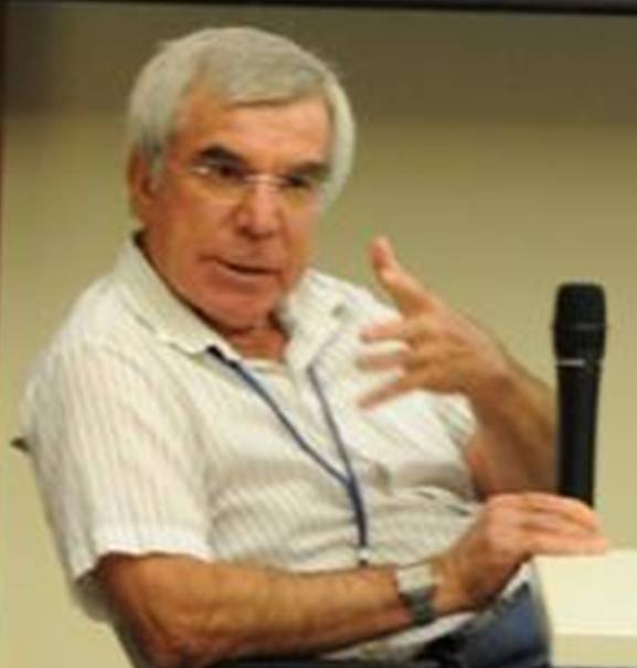
About Thomas Farr: After a short time as an engineering geologist, Thomas Farr (B.S., Geology, California Institute of Technology, 1974, M.S., Geology, California Institute of Technology, 1976, Ph.D., Geology, University of Washington, 1981) joined the Radar Sciences Group at JPL, where he has been since 1975. At JPL, he helped develop the first geologic applications of imaging radar using aircraft, satellites, and the Space Shuttle. He was the Deputy Project Scientist on the Shuttle Radar Topography Mission, and has also been involved in European and Japanese radar satellite programs as well as in the interpretation of radar images from Venus and currently from Saturn’s moon Titan. Tom’s current projects include piecing together the paleo-hydrology of the Sahara with radar images and monitoring of groundwater with radar.

See the flier for directions and details. Contact us at [email protected] if you have any questions.

Lecture by Israel Galin

Millimeter-wave Radiometers for Operational Weather Satellites

Israel Galin, Northrop Grumman Consulting Engineer

Wednesday, June 19, 2013, 5:30–7:30 PM

Buwalda Room, 151 Arms Laboratory

Caltech Campus, Pasadena, California

Talk Abstract: Millimeter-wave radiometry has been a key observational tool for atmospheric remote sensing from space. Examples include operational monitoring of sea-ice coverage, cloud liquid water column density, and temperature profiles. Northrop Grumman has been a vertically integrated systems house over its 50 year history in radiometry. As off-the-shelf space technology has matured over the years, Northrop Grumman has focused more on integrating these components with custom technology items such as mixers and amplifiers. This talk will present the speaker’s vast experience in mixer and multiplier device technology and its role in creating operational weather monitoring space systems, including SSM/T-1, SSM/T-2, SSMIS for the Defense Meteorological Satellite Program (DMSP).

IsraelGalinAbout Israel Galin: Mr. Galin (RF/Microwave Design (Level 6), Northrop Grumman, Azusa, CA) received his B.S. degree from Technion, Haifa, Israel in 1971 and his M.S. degree from University of Massachusetts, Amherst, MA in 1978, both in Electrical Engineering. He also received his MBA degree from Claremont Graduate University, Claremont, CA in 1987. Mr. Galin has over 40 years of engineering experience in the high-frequency (0.3–500 GHz) technology, performing R&D, design, and leadership functions. Working in the U.S., Europe, and Israel, he has developed high-frequency systems, components, and solid-state devices—radiometer front-ends, filters, multiplexers, multipliers, oscillators, mixers. Over the years, Mr. Galin has acted as an engineer, a technical consultant, class instructor, a team leader, a group supervisor, and a special program manager. Mr. Galin taught high-frequency technology classes at Cal Poly Pomona (1981), the UCLA continuous education program (1983–1984), and Harvey Mudd College in Claremont (2000–2001). For over 15 years, Mr. Galin has been conducting short-courses on Analog microwave, millimeter-wave, and THz components Signal Integrity in high-speed digital electronics on-site at Caltech, JPL, NASA, and nationally. Mr. Galin is the recipient of prestigious Aerojet RB Young Innovative-Technology awards (1987, 1998), and the 1998 GENCORP’s award, and several certificates of recognition. He holds one patent (2001), and two current patent disclosures. He is a senior member of the IEEE since 1983. Mr. Galin published over 30 articles and technical papers and presenting his work on-site, and in numerous national and international conferences.

See the flier for directions and details. Contact us at [email protected] if you have any questions.

Save the Date: Lecture by Israel Galin

Please save the date for the upcoming Chapter lecture

Millimeter-wave Radiometers for Operational Weather Satellites

 Israel Galin, Northrop Grumman

Wednesday, June 19, 2013, 5:30–7:30pm, Buwalda Room, Caltech Campus, Pasadena

We will send more details soon. For questions, email us at [email protected]. Follow us on Twitter @LosAngelesGRSS to get updates on the Chapter events!

Technical Poster Session

The IEEE Geoscience & Remote Sensing Society Chapter in Los Angeles presents an event to connect the local GRSS community.

Technical Poster Session

April 17, 2013

Buwalda Room, 151 Arms Laboratory

Caltech Campus, Pasadena, California

Bring a poster, model, demo, or other portable artifact describing your work.  The item could be old or new, related to remote sensing or not. We will have poster stands and tables to accommodate.  Posters will be arrayed in the room and on the outdoor areas just outside the room.

The idea is simply to engage your colleagues with a topic that inspires you and may inspire them, with minimal effort on your part. Please bring yourself, and any colleague interested in becoming a member of GRSS.  We will have GRSS enrollment forms at the event.

Refreshments will be served!