ATLIS: Advanced Technology Land Imaging Spectroradiometer: a Next Generation Sustainable Land Imager
The IEEE Los Angeles Geoscience and Remote Sensing Society Chapter and University of Southern California Present a Special Lecture Event!
ATLIS: Advanced Technology Land Imaging Spectroradiometer: a Next Generation Sustainable Land Imager
Dr. Jeff Puschell
Principal Engineering Fellow and Chief Scientist Space Systems at Raytheon Space and Airborne Systems in El Segundo
Wednesday, Oct 24, 2018
6:00–8:00 PM
EEB 132, Viterbi School of Engineering
University of Southern California,
Los Angeles, CA 90089
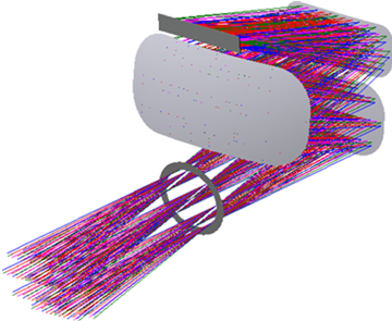
About the Talk: The Advanced Technology Land Imaging Spectroradiometer (ATLIS) is a small (0.04 m3), multispectral pushbroom imager to provide visible through shortwave (VSWIR) calibrated imagery for the Sustainable Land Imaging-Technology (SLI-T) reference mission architecture (RMA).
ATLIS is designed to provide imaging spectroradiometry that meets SLI-T RMA key parameters with an instrument that is much smaller and much less massive than previous land imaging systems.
This presentation describes a NASA ESTO funded project to design, build and test a six spectral band prototype ATLIS called ATLIS-P that will establish whether this compact, low mass design approach with wide field of view (WFOV), free form reflective telescope, large format, small detector digital FPA and on-chip processing meets SLI-T RMA VSWIR requirements. ATLIS is supported by NASA ESTO through grant NNX16AP64G.
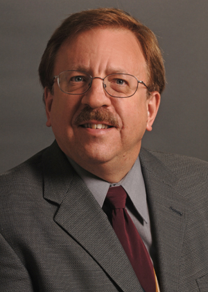 About the Speaker: Dr. Jeff Puschell is Principal Engineering Fellow and Chief Scientist, Space Systems at Raytheon Space and Airborne Systems in El Segundo, California. He is an internationally recognized expert in the system engineering of space-based imaging and remote sensing systems. His 30+ years of experience is broadly based and includes leading and making major contributions to development of visible-infrared instruments for space-based research and operational environmental imaging and remote sensing, development and field testing of laser-based communication and remote sensing systems and building and using millimeter, infrared, visible and ultraviolet wavelength instrumentation for ground-based astronomy. Dr. Puschell has been Principal Investigator, Technical Director, Chief Engineer, Chief Scientist or Project Manager on more than 15 projects in space-based remote sensing and laser communication. He has authored or co- authored 130+ papers on a variety of topics in space-based imaging and remote sensing, optical communication and astrophysics. Dr. Puschell is co-editor and co-author for the leading reference book Space Mission Engineering: The New SMAD. He is a Fellow of the AIAA and SPIE.
Directions and Parking: Parking Reservations @ Downey Way Structure ($12.00 / Day) at USC Viterbi School of Engineering accessible off Exposition Blvd, University Park, Los Angeles, CA 90089: Directions
Reservation: Please RSVP at Eventbrite jere: https://www.eventbrite.com/e/atlis-advanced-technology-land-imaging-spectroradiometer-lecture-event-tickets-50099738667
WebEx Information: If you cannot join in person, please join in remotely through WebEx: https://ieeemeetings.webex.com/ieeemeetings/j.php?MTID=m32c824c7b991d69f27ec0ca42bde71a7
Meeting number: 597 555 127
Meeting password: sm4d3XFZ
Contact information: Please contact us at la.grss.officers@ieee.org if you have any questions
Please see the event flyer for agenda and other details.