Lecture by Thomas Farr
Landscape Changes in the Months Following the Station Fire, Arroyo Seco, California
Thomas Farr, Jet Propulsion Laboratory
Wednesday, August 21, 2013, 5:30–7:30 PM
Buwalda Room, 151 Arms Laboratory
Caltech Campus
Pasadena, California
Talk Abstract: Following the 2009 Station Fire, which devastated a large section of the San Gabriel Mountains of Southern California, Thomas Farr began a series of observations in the Arroyo Seco watershed to document landscape changes brought about by the fire and subsequent rainfall events. These observations were undertaken on runs 5 to 10 km up the Arroyo from JPL and took the form of field notes and repeat photography of several sites. The in-situ information was supplemented with remote sensing data. In the 3 months following the fire, dry processes such as ravel were observed, but on December 13, 2009 and February 6, 2010 intense rainfall events occurred that produced extensive modification of the Arroyo. Initially much woody debris was washed into the channel, followed by 2–3 m of coarse sediments. The hillslopes above the Arroyo experienced shallow rilling and stripping of a few centimeters of soil. Later rain events eroded the aggraded sediments, depositing them in the Devils Gate Reservoir.
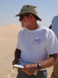 About Thomas Farr: After a short time as an engineering geologist, Thomas Farr (B.S., Geology, California Institute of Technology, 1974, M.S., Geology, California Institute of Technology, 1976, Ph.D., Geology, University of Washington, 1981) joined the Radar Sciences Group at JPL, where he has been since 1975. At JPL, he helped develop the first geologic applications of imaging radar using aircraft, satellites, and the Space Shuttle. He was the Deputy Project Scientist on the Shuttle Radar Topography Mission, and has also been involved in European and Japanese radar satellite programs as well as in the interpretation of radar images from Venus and currently from Saturn’s moon Titan. Tom’s current projects include piecing together the paleo-hydrology of the Sahara with radar images and monitoring of groundwater with radar.
See the flier for directions and details. Contact us at la.grss.officers@ieee.org if you have any questions.